JOHN S. ALLEN'S BICYCLE FACILITIES, LAWS AND PROGRAMS PAGES |
||
 |
Top: Home Page Up: Bicycle facilities Previous: Franconia Notch path |
 |
JOHN S. ALLEN'S BICYCLE FACILITIES, LAWS AND PROGRAMS PAGES |
||
|
Top: Home Page Up: Bicycle facilities Previous: Franconia Notch path |
|
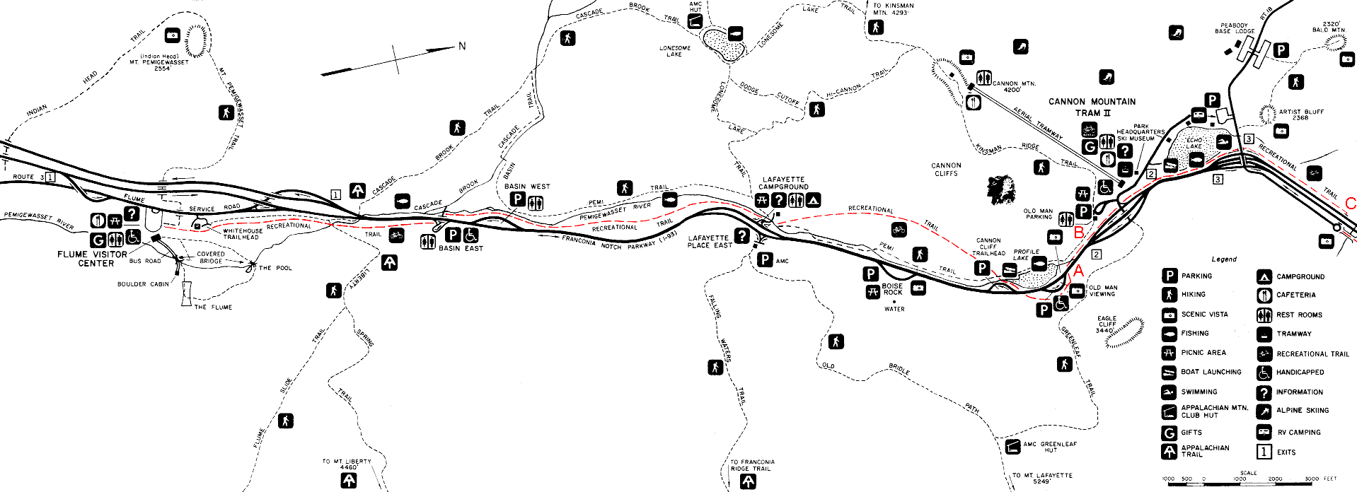
| This map is scanned from a flyer distributed at the State Park. The trail which I have
colored in red is the one intended to substitute for bicycle travel on the highway. Notice
that the trail is labeled "recreational trail" rather than "bicycle
path." I suspect that this labeling reflects legal concerns about its failure to
conform to AASHTO design guidelines for a bicycle path. North is to the right on this map.Scroll to the right end of the map to find the map legend, and the locations shown in the photos on other pages.. |
 |
| Top: Home Page Up: Bicycle facilities Previous: Franconia Notch path |
Contents © 2001, John S. Allen Last revised 5 December2002 |