Top: Home Page
Up: Table of Contents
Previous:
Next:
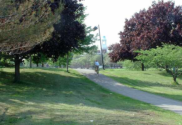
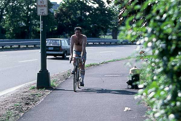
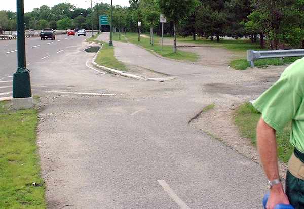
| This section of the path was built in 1980-1981 when the paths were extended. After crossing Western Avenue, the path passes through a wide section of the riverfront parkland opposite the Harvard Business School. This is one of the most open sections of the path, except where it rises and falls to cross a walkway. (The walkway connects the Weeks Footbridge over the river with a pedestrian overpass over Soldiers' Field Road into the Harvard Business School campus.) Here, cyclists may be hidden from each other by the rise. The path has a dashed centerline through the entire segment between Western Avenue and North Harvard Street. A solid centerline would be appropriate where the sightlines are obstructed. |
Open area, but rise results in short sightline
at crossing of path from Weeks footbridge.
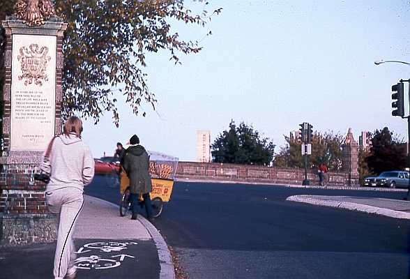
| The Weeks footbridge and the overpass over Soldier's Field road would be very useful for cyclists, except that they pre-date accessibility laws and have stairs. The footbridge has only a few steps, so carrying a bicycle is an option. The overpass has a long flight of stairs. The crossing at North Harvard Street (the Anderson Bridge) is one of the more troublesome in the system. For years following the extension of the path past this bridge, there were no signals for the path, and no convenient curb cuts, as shown in the photo below, which looks east (downriver).. |
Boston end of the Larz Anderson Bridge, 1983.
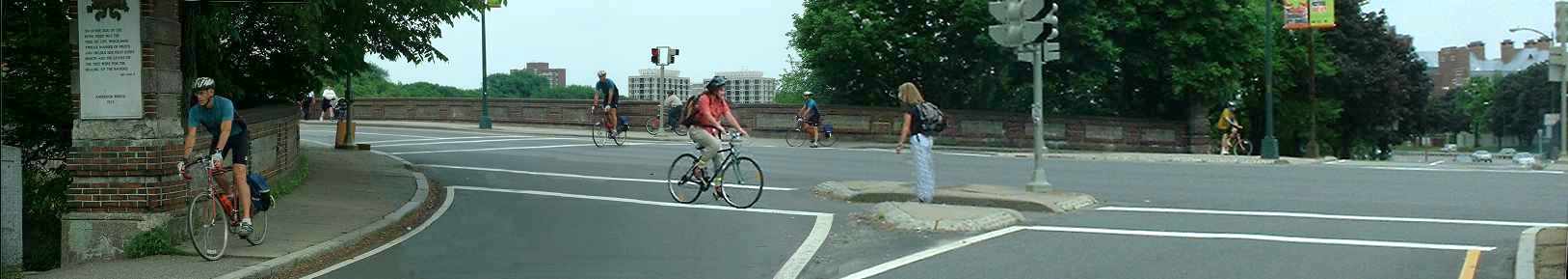
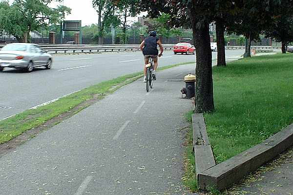
| As of 2003, signalization and markings have been improved, and there are curb cuts,
but the bridge sidewalk, which is the designated through route for the path, remains
as narrow as it was, with the sightline obstructions posed by the pillars at the ends. The photo below is a composite, to show common cyclist routes through the intersection, with its sharp turns and blind corners. All people are shown in the positions in which they were actually photographed. The cyclist in the blue jersey is shown three times, taking the designated route east to west for the path. The cyclist in the red blouse and the pedestrian with the backpack were photographed at the same time. A moment later, they passed each other in the narrow cut between traffic isalnds, with a crub on each side.. The cyclist in the yellow jersey (scroll right) is waiting to cross in the left crosswalk. During the time the photos were taken, many motor vehicles passed through the intersection. They are not shown in this photo because the cyclists were photographed crossing when they could avoid conflicts with the motor vehicles. |
Larz Anderson bridge, looking west to east across the
Boston end.
Scroll left to read text |
| This intersection, like several others in the Paul Dudley White system, is a sorry
example of the retrofitting of a designated bicycle facility into a pedestrian
infrastructure. Knowledgeable cyclists crossing the river on the bridge use the travel lanes. Cyclists traveling along the river do not have that option. When traveling east to west (toward the camera) , they do not have a ramp to enter the roadway -- and so they must jump down over a curb, or else use crosswalks. Cyclists traveling west to east would be riding opposite traffic if they used the roadway, and so the only lawful and reasonable option is to turn left onto the bridge sidewalk and then use the crosswalks. Continuing west, the path runs close to the roadway, with oncoming headlights at night and a number of obstructions, including the hydrant and vegetation below, which are within the specified path width. |
Path west of Anderson Bridge (photo taken 1983)
| As of 2003, a streetlamp post has disappeared, and the grounds are better kept, but another hazard has been added, a wooden barrier directly adjacent to the path, which can catch pedals and topple a bicycle whose wheels stray into it. The trees, also directly adjacent to the path despite a wide expanse of lawn in which they could have been planted, have grown and it is only a matter of time until their roots begin to heave up the pavement. All of these hazards violate AASHTO guidelines. |
Same location, 2003
| The path next passes a Harvard boathouse. The driveway for the boathouse parking lot has a curb that extends halfway across the path (photo below, looking downriver). |
Curb at Harvard boathouse (photo taken 1983)
| As of 2003, the wooden curb along the edge of the path makes for an even tighter squeeze here than before. There is now a wooden railing on the inside of the highway guardrail (lower right corner of photo), sufficient to keep the I-beam posts from tearing up a cyclist's leg but not to prevent a pedal catch. |
Same location, 2003
| Looking upriver from the same location, the path continues across the exit driveway of
the parking lot. Here the path turns away from the road to avoid the curbs, but the path
is strewn with gravel. The paved path intended for cyclists closely follows the edge of Soldier's Field Road, like many other parts of the Paul Dudley White paths, making travel at night toward motor vehicle headlamp beams a problem. The dirt path to the right in the photo runs closer to the river and is more scenic. It is used by runners and by cyclists on off-road machines. Though there is a wide expanse of grass and trees, this area of the riverbank sees little use as parkland. It is relatively isolated, being accessible only at its ends at the Anderson Bridge and Eliot Bridge. |
Looking upriver along Soldiers Field Road
from the Harvard boathouse parking lot, 2003
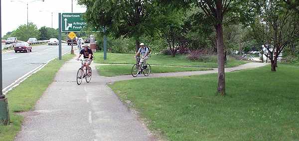
| There is a tunnel each end of the Eliot Bridge. The dirt path along the riverbank
leads directly to the tunnel on the Boston side, but this tunnel is not visible from the
paved path, as shown in the photo below. The path from which the two cyclists are coming
leads from the tunnel. I have seen a father with his young daughter cross the busy roadway at this point because there was no directional sign to indicate that there was a tunnel. |
Approaching the Eliot Bridge. The two cyclists
are riding the path up from the tunnel
under the end of the bridge.
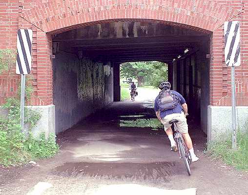
| The tunnel accumulates less water than the one on the Cambridge side of the river. The lights inside the tunnel were working as of June, 2003. |
Tunnel under the Boston end of the
Eliot Bridge, looking upriver toward
Christian Herter Park.