| BU Boathouse. Scroll right to view the rest of the panoramic image.
Scroll left to read text |
Top: Home Page
Up: Cambridge bicycle facilities and program
Previous:
Next:
PAUL DUDLEY WHITE BICYCLE PATH,
|
| BU Boathouse. Scroll right to view the rest of the panoramic image.
Scroll left to read text |
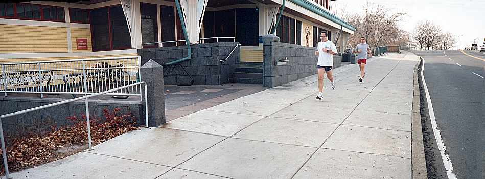
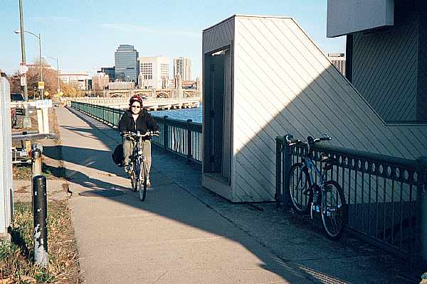
Next is MIT's Pierce Boathouse, whose entry stairs and ramp intrude into the width of the path. |
Pierce Boathouse, November, 2001
The pavement between the Pierce Boathouse and the Harvard Bridge has been heaved up in several places by the roots of trees planted close to the path. The example in the photo below is not the worst one. Root barrier technology does exist for bicycle paths. It is needed here. |
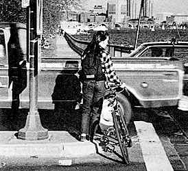
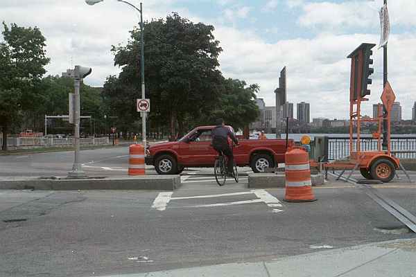
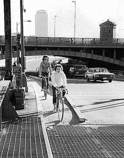
The intersection of the path with the end of the Harvard Bridge (carrying Massachusetts Avenue, at the Massachusetts Institute of Technology) has always been highly unsatisfactory. It has only a narrow median, too narrow to accommodate a bicycle. In 1978, bicyclists had to go around the end of the median. |
Bicycle path crossing of Harvard Bridge, 1978
| When the Harvard Bridge was reconstructed around 1990, following the catastrophic failure of a similar bridge on the Connecticut Turnpike, there was a struggle between advocates of historical preservation and traffic safety advocates. In the end, the preservationists got their historic street lamps and outside railings, but the bridge was widened somewhat. Its greater width included for narrow shoulders, allowing bicycle/motor vehicle lane sharing except at the Cambridge end, where the shoulders were tapered down so the traffic lanes could spread apart to accommodate the median. |
Bicycle path crossing of Harvard Bridge, 1999
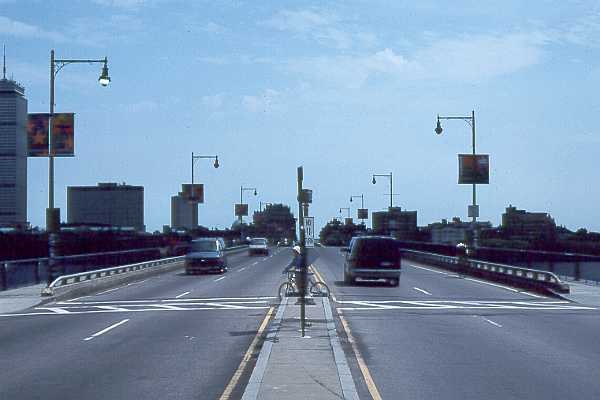
| A five-foot-wide cut was made through the median, so bicyclists no longer had to go
around its end, and crosswalk lines were painted, but there are still no traffic signals,
and the median is still too narrow to shelter a bicycle. The City of Cambridge would like
to have traffic signals installed here, but the intersection is under the jurisdiction of
the Metropolitan District Commission, which has not yet moved forward with the project. In
the photo below, the construction equipment is for work on Massachusetts Avenue, to the
left. Only two years after the photo above was taken, the crosswalk lines have worn away
in places. Memorial Drive passes through an underpass here. Only an underpass or overpass for the path would avoid delays to path users while maintaining the level of service on Massachusetts Avenue. There is ample width in the Memorial Drive corridor for an underpass or overpass. Also, an underpass might be constructed over the river under the end of the Harvard Bridge, as has already been done at the Boston end of the Boston University bridge. |
Bicycle path crossing of Harvard Bridge, 2001
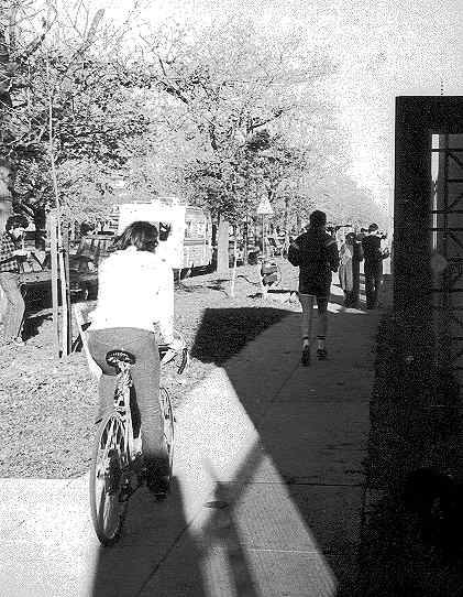
| The entryway of the MIT sailing pavilion (photo below), east of the Harvard Bridge, is the only one intruding on the path that predates its designation as a bicycle path. The doors at least have windows. Note also the park bench immediately next to the path in the background. Path traffic in this 1978 photograph is typical for a warm day. There is no way that a bicyclist can safely travel at normal speeds under these conditions. The problem today remains as it was then. |
MIT Sailing Pavilion, park bench and path traffic, 1978
The Harvard University boathouse in the photo below is just west of the Longfellow Bridge. Its entryway intrudes more effectively onto the path than any other, concealing path users and people leaving the boathouse from one another. It is hard to understand what the point of this structure is other than to support a door frame so unauthorized people do not step onto the walkway that leads to the boathouse -- though the opaque side walls are not needed to accomplish this purpose. A structure like this would be acceptable adjacent to a sidewalk, but is not acceptable when bicycle traffic passes in front of it. |
Harvard University boathouse west of Longfellow Bridge, 2001
Between the Harvard Bridge and the Longfellow Bridge, the median strip of Memorial Drive is extremely wide. If the eastbound travel lanes were moved farther from the river, a riverfront park would be created, comparable with the Esplanade on the Boston side. It would be possible to construct a path which would avoid the hazards at the doors of boathouses. East of the Longfellow Bridge, a similar redesign has already been brought to reality (see below). |
| Median between Harvard Bridge and Longfellow Bridge. Scroll right to view the rest of the panoramic image.
Scroll left to read text |
The path is reduced to a narrow strip where it passes under the Longfellow Bridge. It was clearly an afterthought, borrowed from the lane width of the original roadway underpass, which did not provide a pedestrian or bicycle crossing on the river side of Memorial Drive. The path here is not even wide enough to meet AASHTO guidelines for a one-way path. The guardrail on the river side is so low that bicyclist can easily topple over it into the river. The raised curb between the path and the road is a safety feature as it applies to baby strollers, but can topple bicyclists into the road. And there are lampposts in the path. The travel lanes are wide, and bicyclists sometimes ride on the roadway here, rather than on the path, in the interest of their own safety. It is easy to get from the path to the roadway and back when traveling westbound, but not eastbound. This situation would be expensive to correct. The path might be widened somewhat by borrowing more from the travel lanes, but more widening could be accomplished by cantilevering a structure over the river from the side of the causeway. |
Causeway with path at Longfellow Bridge
The path becomes even narrower at a lift bridge just east of the Longfellow Bridge. Nothing whatever has changed in the design of the path here since the photo below was taken in 1978. |
Bicycle path at Longfellow Bridge underpass, 1978.
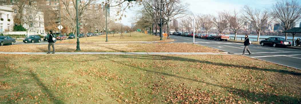
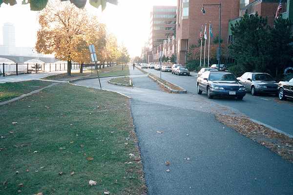
| East of the Longfellow Bridge, there was once a wide highway, the Cambridge Parkway,
along the riverfront. Traffic has now been rerouted to another street one block inland,
and without any significant loss in efficiency of travel. Most of the riverfront highway
has been converted to parkland, and a new bicycle path (center of photo, next to the
narrowed one-way roadway) has been constructed, separate from the riverfront walkway.
These changes represent a real improvement, though the path's location directly adjacent
to the roadway is less than ideal; it places westbound bicyclists in the wrong side of
motor vehicle headlamp beams during hours of darkness. The path could also have been
placed so it did not cross the U-shaped boathouse driveway in the foreground, though this
driveway does get relatively light use. The curbs next to the path between the two walkway
crossings are contrary to AASHTO guidelines, unnecessary, and undesirable, as bicyclists
who stray into them will topple over. Runners, who prefer an unpaved surface, have trodden a path for themselves between the riverfront walkway and the bicycle path.. |
Top: Home Page
Up: Cambridge bicycle facilities and program
Previous:
Next: