Top: Home Page
Up: Table of Contents
Previous:
Next:
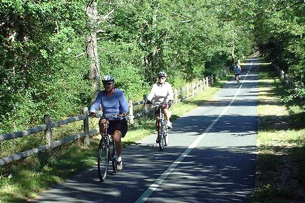
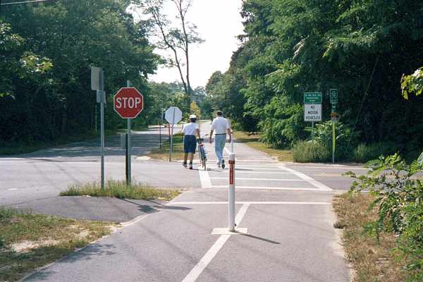
The Chatham branch starts at the rotary intersection that connects it with the main stem of the trail in Harwich. Much of the Chatham branch looks like the photo below -- a reasonable rail trail, with mostly bicycle traffic because it passes mostly through wooded land with few intersections. |
Chatham Branch just east of the rotary, looking east.
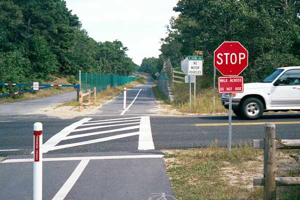
Peculiarities and problemsHowever, there are some peculiarities and problems. In the photo below, looking east across Depot Road in East Harwich, the trail parallels an existing publicly-owned road built on the railbed, and which is open only to occasional traffic (notice the gate). The parallel trail section runs for over 1000 feet. Construction costs, including that of considerable excavation, could have been saved here. Also note the "walk bicycles" signs. These appear at most of the intersections. They have no force of law. There is no basis for the idea that walking is safer, except possibly for a person with very poor bicycling skill -- after all, it is possible to get across much faster on a bicycle than on foot. Many bicyclists ignore these signs. The sign identifying Depot Road, like most identifying streets at crossings in Harwich, is on the red vertical stripe on the barrier post in the middle of the trail -- in small letters, not readable easily by a bicyclist. |
Looking east across Depot Road, Harwich
A better intersection treatmentThis intersection at Route 39 in Harwich has the "walk bicycles" sign, but it also has a good feature, a functional divider in the trail to slow bicycle traffic before the intersection. It would be helpful if the sight line obstructions (at the left side of the picture) could be removed. |
Looking west across Route 39, Harwich
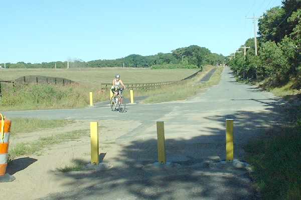
More sidepath segmentsThere are three additional sidepath segments, in addition to the one east of Depot Road. The one shown below, west of Sam Ryders Road in Chatham, is similarly unnecessary. The road is only used rarely, by traffic to a sewage treatment plant. Also note the narrow spacing of the barrier posts. This is typical of the Chatham section of the path currently (September 2004) under construction -- more about the barrier posts later. |
Sidepath alongside road that carries very little traffic,
looking east toward Sam Ryders Road, Chatham
The two sections of sidepath shown up to this point are mostly wasteful rather than dangerous. Bicyclists would be better served by traveling on the roadways here, avoiding the unavoidable conflicts with pedestrian traffic on a mixed-use path. But on the other hand, there is little pedestrian traffic, because of the lack of closely spaced destinations. The other sidepath sections are not so innocuous. The photo below looks west across Oak Street in Harwich along Old Colony Road, which was built on the alignment of the abandoned railroad bed. This is a developed area, with a school, a church and residences, so pedestrian traffic is heavy. Also, in its approximately 1/4 mile, the sidepath along Old Colony Road crosses numerous driveways and two streets. It certainly would have made sense to build a sidewalk here, but the safety and convenience of bicyclists is better served if they are accommodated on the roadway, not on a sidepath. The intersections at the ends of this sidepath segment are particularly troublesome. To the left in the photo below is a driveway of a school. The trail is therefore a sidepath next to a four-way intersection with heavy traffic from all directions at certain times. Bicyclists and motorists must look back behind them to yield at the intersection, no matter which way the bicyclists are traveling. |
Looking west along Old Colony Road across Oak Street, Harwich
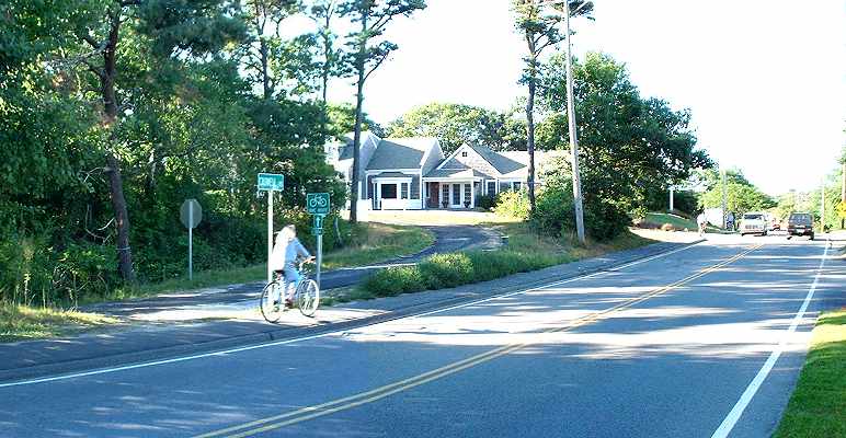
| At Pleasant Lake Avenue (Route 124) at the other end of Old Colony Road, the intersection is nonstandard even as a pedestrian crossing. As shown in the photo below, crosswalk markings end awkwardly at the stop line of a church's driveway (left foreground in photo), also instructing westbound bicyclists to ride opposite the flow of traffic in the driveway, in violation of the traffic law. |
Looking east across Pleasant Lake Avenue (Route 124)
along Old Colony Road, Harwich
Looking west across the same intersection
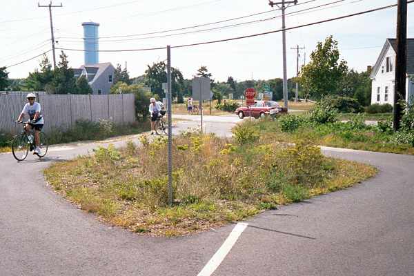
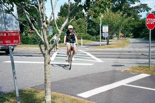
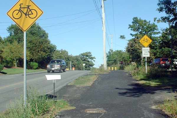
The appropriate treatment for bicyclists here would be to bring the trail out directly opposite the end of Old Colony Avenue, so bicyclists could transition smoothly to/from riding on the right side of the roadway. "Share the Road" signs would have been appropriate. A sidewalk for pedestrians also would have been appropriate. A "share the road" segmentOddly enough, there is another section of the trail, in Chatham, which does accommodate bicyclists on a roadway: Wilfred Road, with "Share the Road" signs. There is no sidewalk, but on the other hand, motor traffic is light. |
Path (foreground) transitioning to roadway east of Chatham airport, looking east
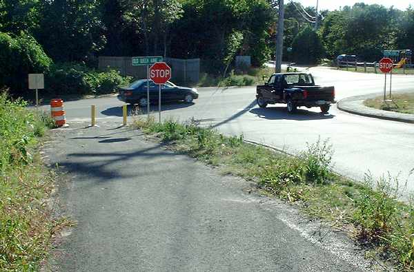
Pillar to post in ChathamBut Chatham also has the most troublesome sections of the entire project. The railroad right of way passed directly across what is now the Chatham airport. The trail from the west terminates at George Ryder Road opposite the airport, only to resume a quarter mile south along this road. As of this writing (September, 2004), there is no sign or marking to indicate how to continue along the trail; and George Ryder Road is rather heavily-traveled and narrow. A detour around the north end of the airport would have been considerably shorter, but for some reason, it was not chosen. East of where Wilfred Road ends at Old Queen Anne Road, the abandoned railroad bed no longer exists either as a railroad bed or as a roadway. The trail continues as a sidepath along Stepping Stones Road, with three very awkward intersections, as shown in the photos below. |
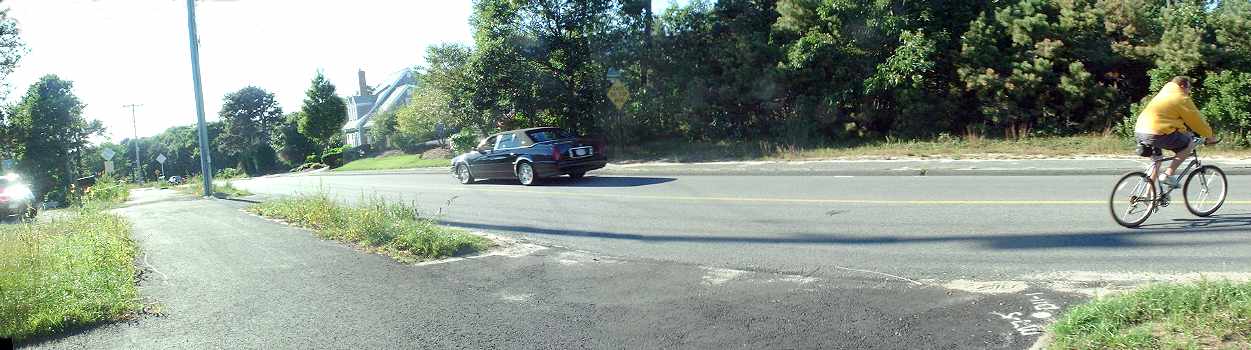
Looking west from sidepath along Stepping Stones Road across
Old Queen Anne Road to Wilfred Road -- a steep downhill slope
leading to a blind corner with barrier posts. There's insufficient distance to merge
to make the left turn in either direction. It's much easier and
safer for bicyclists just to stay on the roadway.
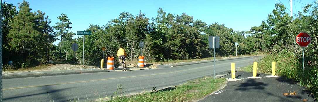
Looking east from the same location. Path crosses driveways.
The "share the road" sign is inappropriate for the sidepath,
but in fact would represent better advice for bicyclists.
At the top of the slope on Stepping Stones Road, a bicyclist
exits a driveway
into the roadway. (scroll right as needed to see the rest of the panoramic photo).
Why did the bicyclist do this?
 |
The bicyclist was avoiding the narrowly-spaced barrier
posts,
limited sight line and sharp turn where the path crosses the road.
 |
| After the path crosses the road, it passes alongside a town athletic field and across the entry to a parking lot for that athletic field. Pedestrian and motor traffic will be heavy here when athletic events are starting and finishing. Then there is another crossing of Stepping Stones Road, shown in the photo below. |
Looking west along the trail. Parking lot and athletic field
in background.
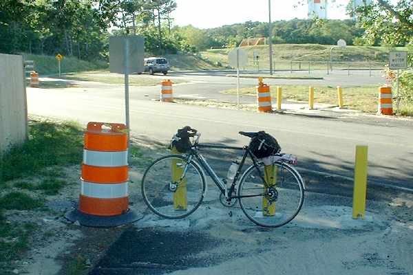
Driveway to parking lot crosses trail. The bicycle's wheelbase is 41 inches, and so
the spacing between posts is approximately 33 inches -- hazardous for all bicyclists.
An adult tricycle or bicycle trailer wouldn't fit through. The AASHTO Guide
specifies 60 inches. But with the many hazards of this pillar-to-post path segment,
bicyclists should avoid it even if the posts are properly spaced.
| The trail goes down a slope and ends at Crowell Road, where the only rideable access is from the sidewalk, because there is no curb cut to the roadway. |
End of trail at Crowell Road
Recommendations,
|