Top: Home Page
Up: Table of Contents
Previous:
Next:
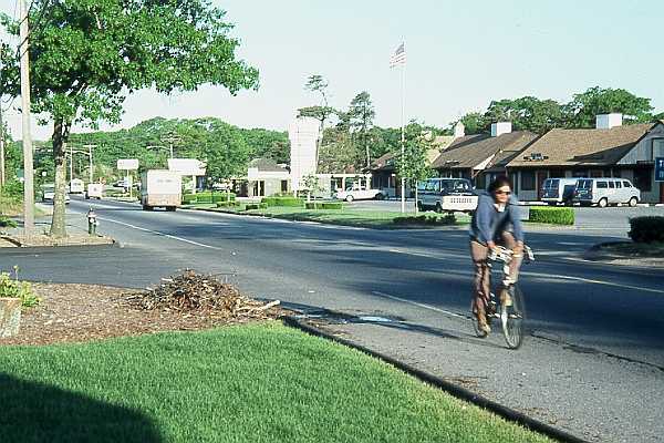
Route 28 in Hyannis was not a very attractive place to ride a bicycle before a bicycle sidepath was built along it. Traffic was heavy, and there were two 12-foot lanes with no shoulders. Photos below were taken in 1985, except as indicated. The photo below shows typical conditions, except that the photo was taken in the early morning on a weekend and the traffic is light. The bicyclist is riding his road bicycle on a rough, gravel shoulder. |
In 1980, a sidepath was built along the south side of Route 28 from Bearse's way to West Main Street. The town justified it with the claim that it was building a safe route to the local high school, which is located on Route 28. I don't think the sidepath improved conditions. In its 1 1/2 miles, it crosses 8 streets and 23 driveways. It has all the usual hazards of sidepaths, and some special ones of its own. Typical conditions are shown in the photos below, which were taken in 1985, 5 years after construction of the path. The first photo shows intersection hazards which confront a bicyclist traveling west: poor sight lines due to vegetation, no crosswalk markings whatever, and a stop line after the path. The motorist entering from the cross street will be looking to the left if turning right. A bicyclist proceeding in the direction the camera is pointing faces an extremely high crash risk, as shown in the Pasanen and Wachtel-Lewiston studies, among others. It is entirely possible for a bicyclist to obey the stop sign, restart and still be struck by a vehicle whose driver had been preparing a right turn. |
| The photo below shows what drivers in the cross street see as they approach one of the intersections. At this intersection, the stop sign and bike route sign as well as the stop line are after the bicycle path, and again, there are no crosswalk markings. A motorist can easily conclude that the bike route is on the road, and that the paved strip before the road -- if noticed at all -- is a driveway, so there is no need to yield to traffic on it. |
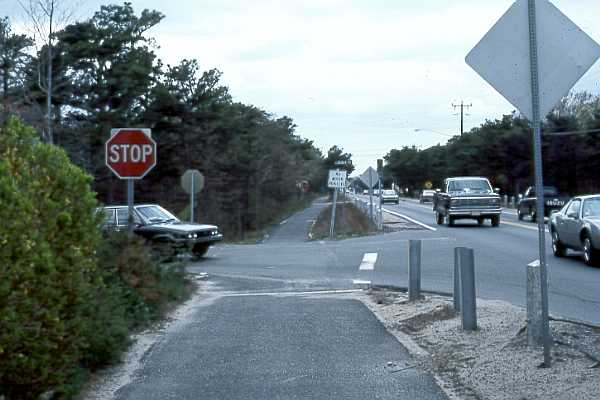
| At the intersection shown in the 2001 photo below, the stop sign is before the path, but there is no crosswalk marking or stop line. Such conditions are typical of intersections with minor cross streets. |
Here, at the entrance to a parking lot for a small business, the path is directly adjacent to the roadway. Aside from the typical hazards of crossing and turning traffic posed by wrong-way bicycle traffic, the path is not delineated or marked in any way here, and the pavement has deteriorated. |
| The next photo shows a sight line problem posed by an embankment and vegetation next to the driveway of the Hyannis Youth Hostel (now closed). |
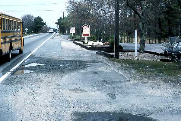
| At its east end, the path dead-ends at the driveway of a small shopping center -- in
the photo below, where the light blue pickup truck is entering from Route 28. The
"end bike path" sign is just to the right of the closer electric pole in the
photo. Upon reaching this end of the path, a bicyclist has three alternatives:
Notice also that motorists have driven across the sand in the foreground to enter the parking lot. They can avoid waiting in a traffic queue by cutting through the parking lot to turn right onto Bearse's Way.. The hazard of a faster bicyclist approaching as a slower motorist turns right occurs here just as at the driveway. |
| As of the year 2001, this situation had not changed substantially. |
| There is no good way to enter the path at this end. Entering from the parking
lot involves turning left across the driveway, while vehicles may suddenly turn to enter
the driveway. Entering from Route 28 requires making a left turn into the driveway, and
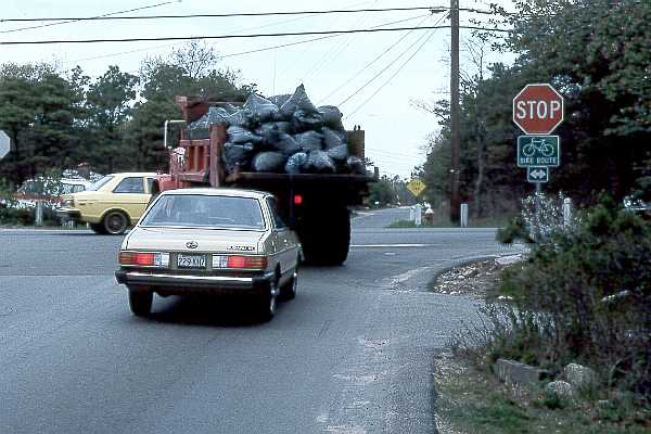
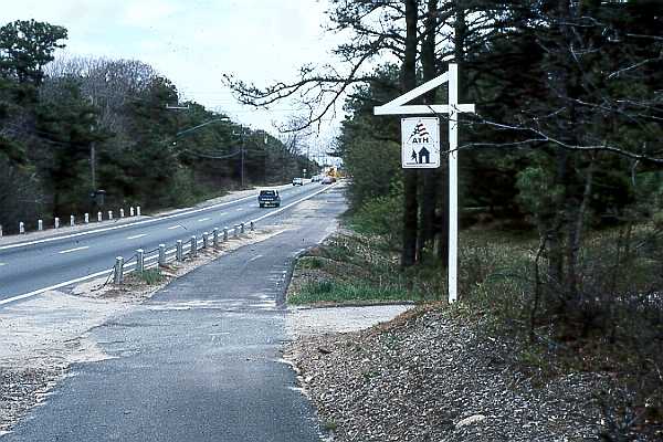
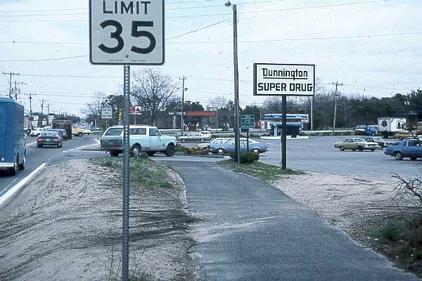
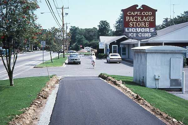
then immediately turning sharply right. In 1986, the path was extended about another mile, as far as Old Stage Road. The newer section crosses a shopping center driveway, and passes through the apron of a filling station and the parking lot of a liquor store (photo below taken August, 1986). |
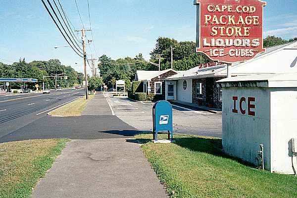
| Ironically, the owner of the liquor store was an avid bicyclist. Both he and the
houseparents at the Youth Hostel had expressed their concerns about the design and
location of the path, as I also did, but to no avail. As of the year 2001, a reconstruction project has separated the path from the parking lot, though the conflicts at the entryways remain, and a new mailbox constitutes a sight obstruction. No accomodation for bicycling has been made on the roadway, as is to be expected when the community considers sidewalk bikeways to be adequate. The pedestrianization of bicycling is now set in asphalt, both in the bikeway istelf and in the roadway. |
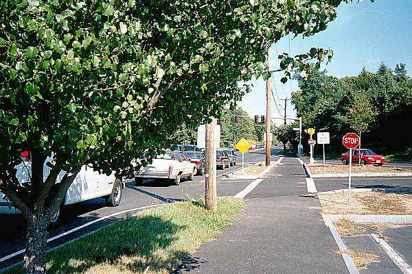
| At Phinney's lane, just east of the liquor store, the intersection has been upgraded
with a traffic island. The design here is appropriate for pedestrians but unsuitable for
bicycle use. The planing of a small tree where it cuts sight lines between the path and
road is a particularly unfortunate touch. So are the curbs next to the path in the traffic
islands. Intersections that include sidewalk-type bicycle paths can be either safe, on the Dutch model with a separate signal phase for the bicycle path, or efficient, on the American model, where the bicyclist's safety is taken for granted -- but not both. Accommodating bicyclists on the road is both safe and efficient, except for child bicyclists. |
| Why have facilities with such serious problems as this one been built? My conclusion
is that Cape Cod communities found a way to construct sidewalks using bicycle funding, and
ran with the opportunity. Safety for children was one of the major reasons given for construction of the path. Because of the confusing, nonstandard intersections, a sidepath like this can not create acceptably safe conditions for anyone to ride bicycles, but the hazards are especially severe for children, who are less likely to be alert to them. What should have been done here? What still could be done?
The construction of the 8-foot path does not preveent future widening of the roadway to accommodate bicycle better. Reduction in the speed limit, and other improvements such as signalization, might be considered to increase safety. Other streets in Hyannis, such as West Main Street, might be improved as alternatives. Other potential routes could be created using short trail segments to connect lightly-traveled residential streets and collector streets. |