Top: Home Page
Up: Table of Contents
Previous:
Next:
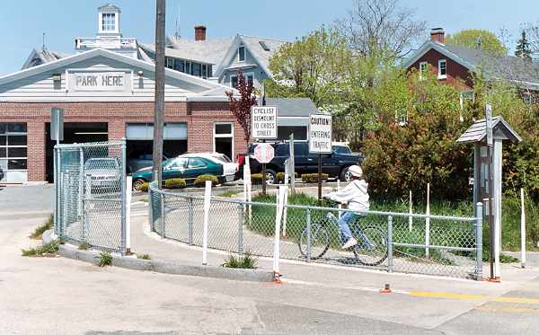
The Shining Sea Bicycle path from Falmouth to Woods Hole follows an abandoned railroad right of way, and at the Woods Hole end, traverses two Steamship Authority parking lots. The entrance to the path from the street is very tightly constrained by fences and posts, and includes signs instructing bicyclists not only to stop, but also to dismount when crossing the street, as shown below. Just what advantage there is in dismounting is questionable, as a dismounted cyclist takes longer to cross and is more likely to get in the way of other cyclists. |
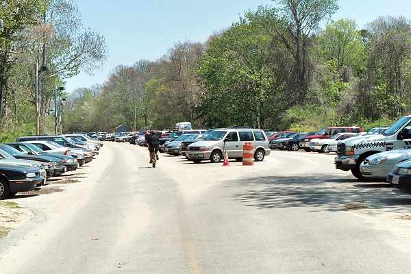
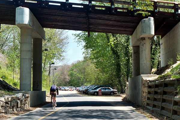
The path then proceeds through the first parking lot, as shown in the photo below. Note the blacked-out lines; the path has been moved to place all the parking spaces on one side, an improvement not observed by the driver who parked the car on the left. In the background of the photo, the path continues along the former railroad right of way under a bridge and along one side of the roadway that leads to a second parking lot. |
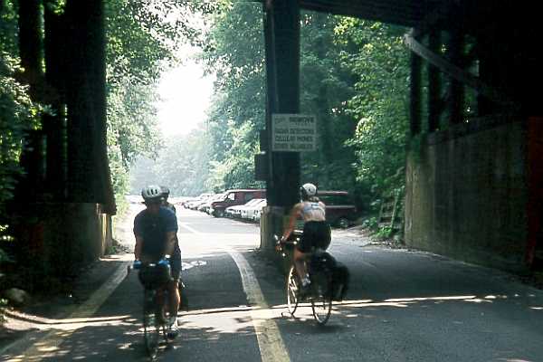
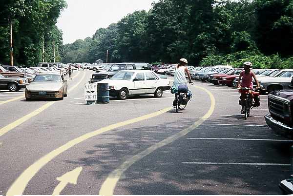
As the roadway continues under under a second bridge, bicyclists traveling in both directions are directed to one side of the roadway. Bicyclists traveling away from the camera, into the parking lot, are directed head-on toward oncoming motor vehicles, in a narrow lane with no way to escape, in the photograph below taken in 1995. |
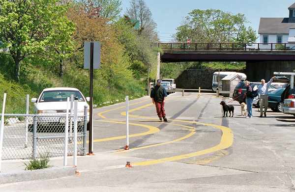
As of May, 2003, a new bridge without pillars in the middle of the roadway had been installed, but the routing of the path was still along one edge of the roadway. And now it is narrower. |
A little farther along, in the parking lot, the bike path stripes continue down one side, into the face of oncoming traffic, contradicting a "Keep Right" sign. The family group in the photo below, taken in 1995, is following the stripes, riding opposite the normal flow of traffic. Ahead of the first bicyclist (just above the "keep right" sign in the photo), a car is beginning to pull out. |
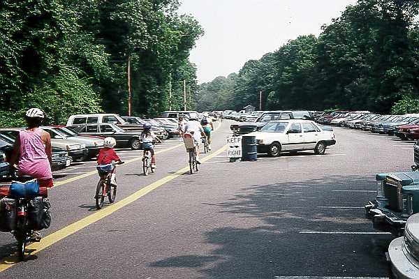
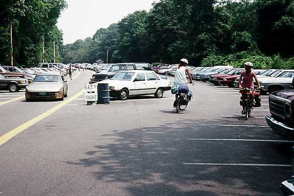
The next photo was taken a few seconds later. The family group is visible in the distant background. The car which was pulling out waited for them and is now leaving the parking lot. The bicyclists in the foreground of this photo know enough not to do what the painted lines instruct them to do. |
| I don't know what the reasoning behind this design was. Maybe the engineers felt such
a powerful compulsion to separate bicycle and motor vehicle traffic that they decided to
create separate rights of way over the exact same same piece of pavement? Beam me up,
Scotty! Or maybe bureaucratic rigor mortis was at work: "the path right-of-way is supposed to follow the old railroad line, so, OK, guys, get out the paint pots." In any case,. this design violates one of the most basic principles of traffic engineering, that of separating traffic according to its direction of travel. Because riding opposite the flow of traffic is illegal, there is a liability risk in designating such a facility. The only sensible design would be to direct bicyclists to keep right with the rest of the traffic, to avoid head-on conflicts and so motorists exiting parking spaces would have to expect wheeled traffic from only one direction. I'd consider it appropriate to stripe a narrower, one-way bike lane down the middle of the travel way on each side, to discourage novice cyclists from riding too close to cars which might be about to pull out of parking places, as shown in this altered photo: |
| Notice that the purpose of my suggested bike lane placement is emphatically not
the usual one, to separate motor and bicycle traffic -- quite the opposite. Granted,
routing a bicycle route through a parking lot is not the world's greatest idea in the
first place. But motor vehicles in a parking lot don't go any faster than bicycles anyway.
Another possibility which has become known since I constructed the image above would be to use the so-called "shared-lane marking". This indicates a lateral position and direction of travel for cyclists in a lane shared with motor vehicle traffic. This might actually be more appropriate than bike lane stripes, which usually are intended to exclude motor traffic. The measures I have suggested are, in my opinion, as good as possible considering the circumstances. As of May 2003, the stripes for the path had faded, and were partially covered by sand, as shown in the photo below. However, the routing of the path is the same, and the cyclist is following that routing, opposite the normal flow of traffic.. |